Vigicrues
Vigicrues is a French public service offering the real-time results of water level and sometimes flow measurement of a river. There is a very large number of measuring stations spread throughout the territory whose results can be integrated natively into your monitoring tool.
The Vigicrues instance gathers the water level at the station (m), as well as the strength of the flow (m3/s). Options
- Name*: Just a simple label to find it easier in the SenHub's interface
- Description: Description for your own usage only.
- Group: optional — assign this instance to a group to organise it within SenHub.
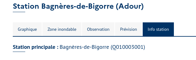
- Hydro station code: Find the station you are interested in on the website www.vigicrues.gouv.fr. Once on the station page, its code can be recovered in the Info station tab*, between parentheses.
Example output
For the selected hydro station, the connector returns the current water level (m) and, when the station also measures it, the flow rate (m3/s):
{
  "metrics": [
    { "channel": "Water level", "value": 1.85, "unit": "m" },
    { "channel": "Flow", "value": 42, "unit": "m3/s" }
  ],
  "message": "Metrics successfully retrieved.",
  "status": "OK",
  "date": 1725981405127
}
Stations that only publish a water level (grandeur H) return just the Water level metric: