Explore
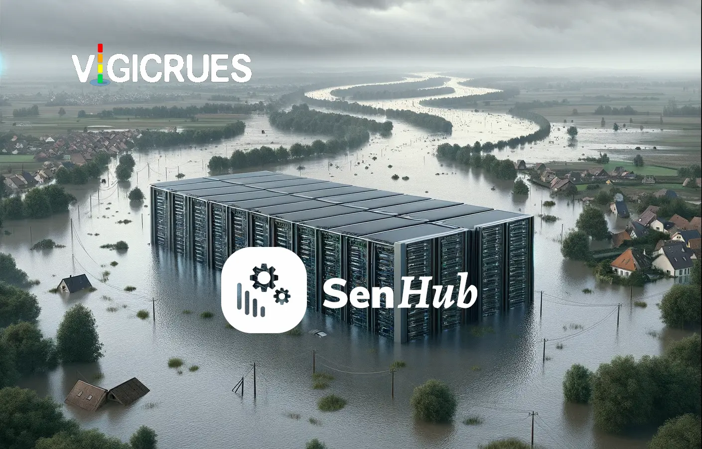
Are your data at risk of swimming in water?

By Yann Garras
12 January 2024 • 3 minutes read
Welcome to our latest blog post, where we dive into the fascinating intersection of environmental technology and risk management for critical infrastructures. We’re excited to introduce two innovative connectors from Senhub: Vigicrues in France and PegelOnline in Germany. These connectors play a key role in flood risk prevention, particularly for data centers located near or below river levels.
In a world where data security and operational continuity are paramount, the ability to monitor water levels in real time is essential. With Vigicrues and PegelOnline integrated into your monitoring tools, you can now be alerted immediately to potential flood risks. This feature is crucial for data center managers who need to anticipate and respond quickly to protect their facilities from the elements.
Join us to discover how these technologies are not just measurement tools, but vital guardians of your infrastructure’s safety in an ever-changing environment. Whether you’re a data management expert or just passionate about sustainable technology, this article will provide valuable insights into the importance of water level monitoring in protecting data centers.
What is Vigicrues?
Vigicrues, a French service managed by the Ministry of Ecological Transition, provides alerts and updates on waterway flood risks. This service, which informs the public through various level alerts and safety advice, is freely accessible online and through an app.
Moreover, Vigicrues offers its data as open data for real-time monitoring of water levels and flows in certain waterways. This precise and instantaneous data is particularly useful for monitoring the water level near your data center, for example. Thanks to Senhub, it’s possible to integrate this data into your IT monitoring, optimizing your responsiveness to flood risks.
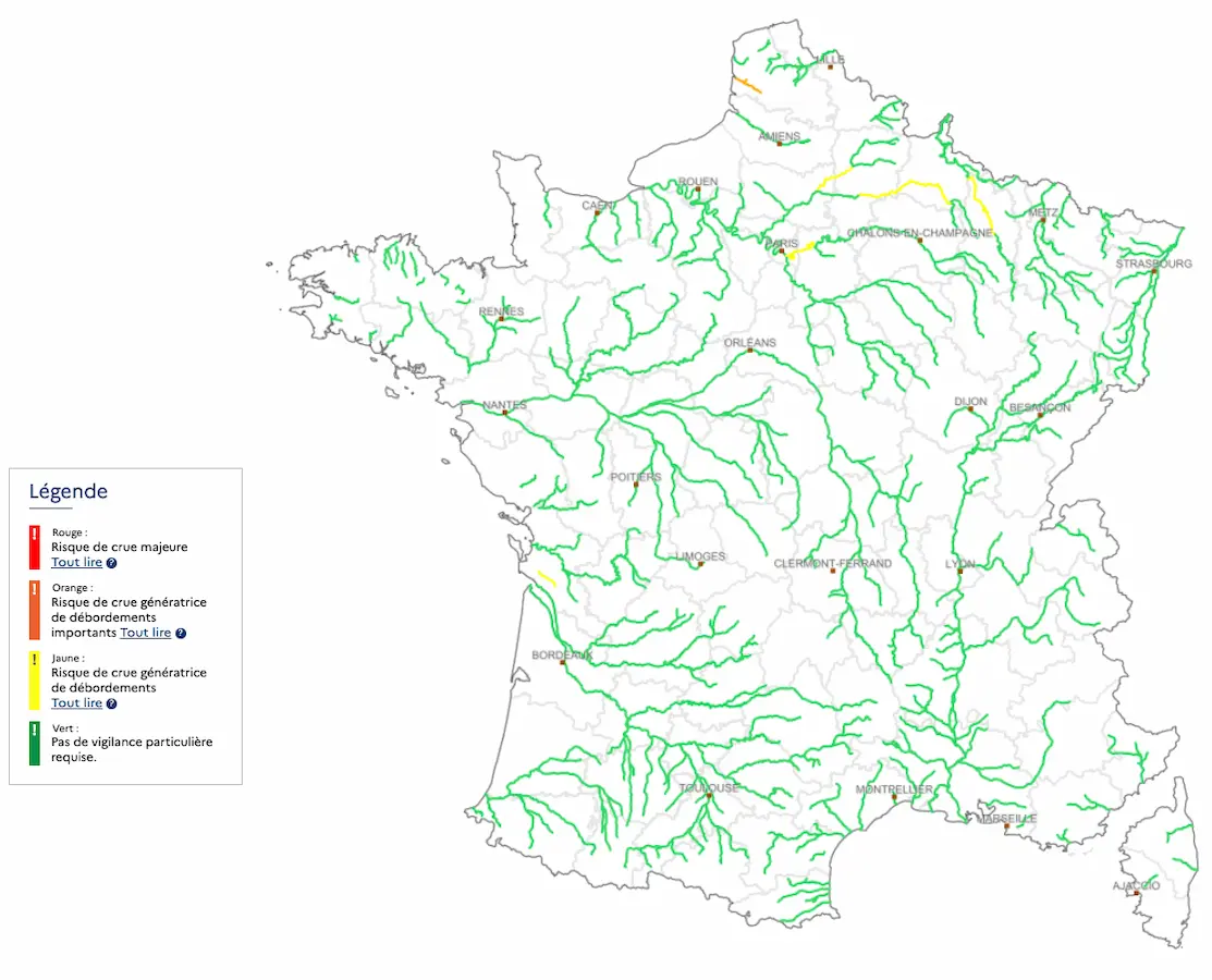
Vigicrues alert map
And PegelOnline?
It’s the same concept, but for Germany.
PegelOnline is a service of the Federal Waterways and Shipping Administration (WSV) for the timely provision of water data. It provides updated water data on about 660 levels on federal waterways. The measured values at coastal levels are recorded every 15 minutes on inland routes and updated regularly, up to once a day.
Implementation in Senhub
Both services require no authentication. The only parameter to provide is simply the identifier of the measuring station. The information can be found here for Vigicrues and here for PegelOnline.
Each connector is easily configured by setting the site identifier.
And that’s it!
Not all information is always available. Indeed, not all stations measure flow rates, for example. But overall, the service is delivered! By setting thresholds on the water level near you and especially upstream of your site, you are alerted to danger and can organize the defense of your infrastructure, switch to a secondary site cleanly and without haste, and organize the relocation of your users.
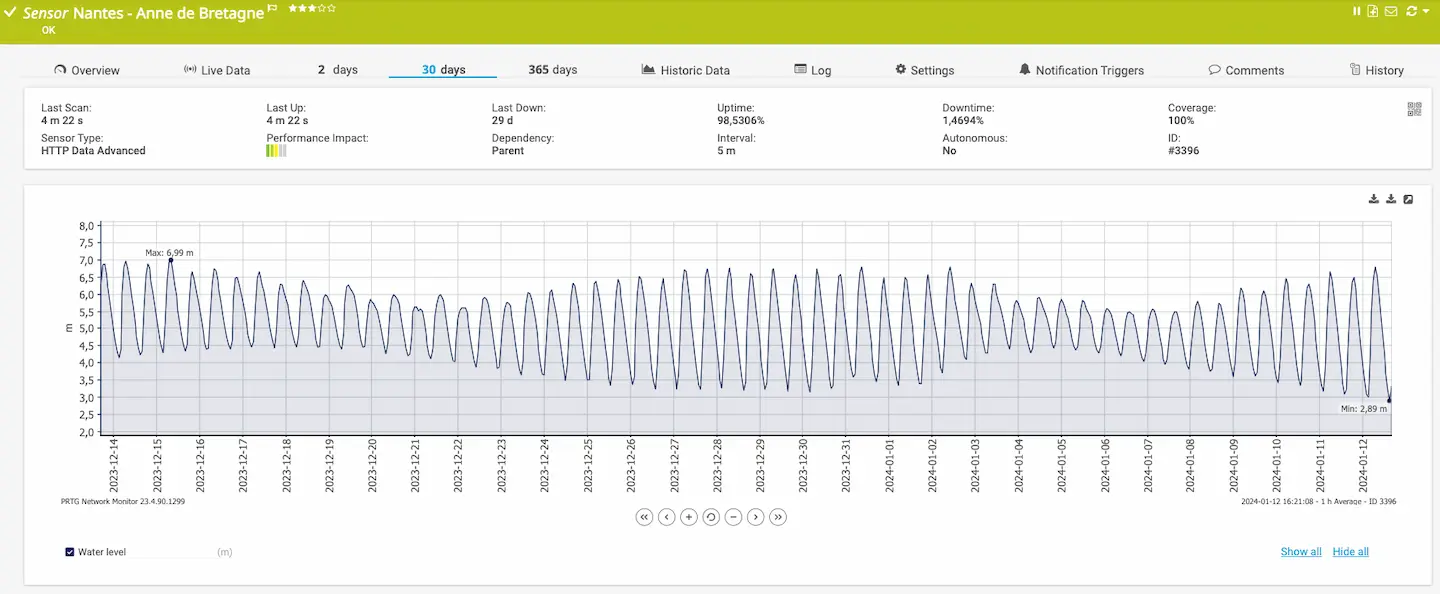
What is this river that changes level like the wind?
Here we follow the water level of the Loire, which is subject to the tides. So you can know at a glance the best time to go fishing!
{
  "prtg": {
    "result": [
      {
        "channel": "Water level",
        "value": 4.77,
        "unit": "custom",
        "customunit": "m",
        "float": 1
      }
    ]
  }
}
Keep your data safe from the weather!
In conclusion, given the rapid climate change and its increasingly significant impacts, the issue of flooding becomes crucial for both people’s safety and infrastructure preservation. The devastating consequences of floods, exacerbated by these climate changes, remind us that many sites once considered safe might no longer be.
This reality underscores the importance of monitoring and prevention systems like Vigicrues, coupled with tools such as Senhub, which allow for real-time integration and analysis of water data. These technologies are not just measurement tools, but vital guardians that help us anticipate and respond to increasing emergency situations.
In a world where extreme weather conditions are becoming the norm, it is imperative to stay vigilant and proactive. Integrating these advanced technologies into our risk management strategies is a crucial step towards greater resilience in the face of challenges posed by climate change.
For the moment, this service is only available in France and Germany, but all suggestions are welcome to extend this service to other regions of the world!
Newsletter
Senhub is constantly evolving. New connectors are available regularly. Keep up to date by subscribing to our newsletter.

You can have a look at Senhub,
right now
A proof of concept is worth all the big explanations. You can try Senhub now, with no commitment.
Simply create your account (no credit card required) and start monitoring your cloud assets with your very own monitoring tool.
If you have any questions, send us an e-mail at contact@senhub.io or open our chat window to talk to one of our Senhub buddies.